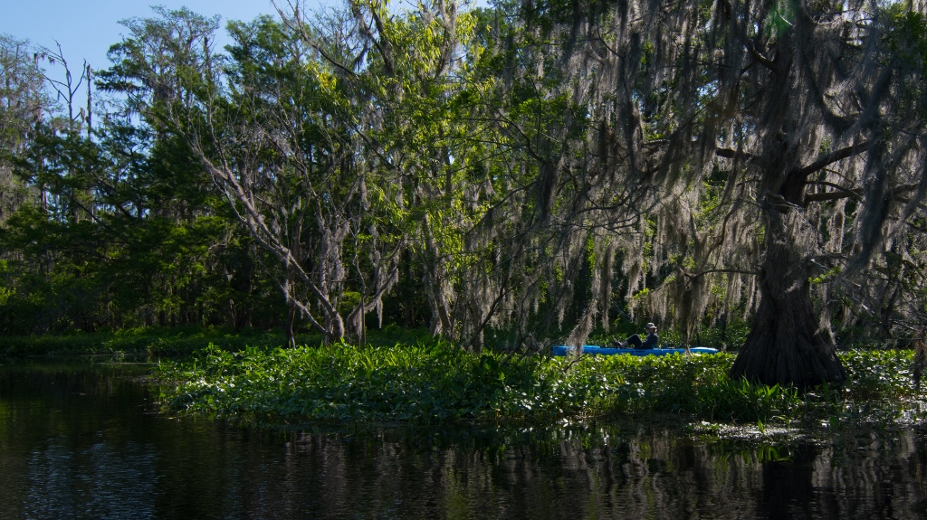
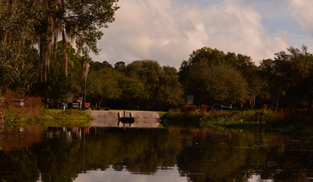
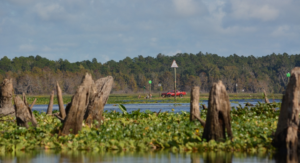
We were all ready to take the yaks out to the new Blue Springs State Park on the Santa Fe River, when we realized it was spring break for area schools. With warm weather, we figured the large crowds would be a noisy distraction. Instead, we headed over to Cross Creek where we haven’t been for several months. The boat ramp is located next to the Marjorie Rawlings Historic State Park.
When we arrived, the parking lot was over half full with more boat/trailers arriving by the minute. Apparently, the fishing was good this day. Once on the water, we came across just one motor boat. Seems most of the boats were headed out to Orange Lake which left the creek quiet and calm.
The water level was about average with little to no current noticed. The cool morning air and light breeze made for an easy paddle. The creek is approximately 1 mile long and runs between Orange Lake and Lake Lochloosa.
There are three ways to get in the water but not get too wet. Wear a dry suit, rent a submarine, or paddle a kayak. Dry suits are uncomfortably hot and submarines can be pricy. A kayak is sounding pretty good now!
Log home along the creekA group of kayakers we met
It’s been a while since I posted anything on crossingcreeks and thought it was about time I did. After several outings over the past several months to places I have already written about, I decided to try a new (or almost new) location. On this day I, along with Kathy, headed out to Lake Kerr, located in the Ocala National Forest. We launched at Moorehead Park, located on the west side of the lake. There is a concrete boat ramp, floating dock, restrooms, and some picnic tables. Best of all, it has a nice beach area for launching a kayak or canoe.
Due to the clarity of the water, I think this must be a spring fed lake. I couldn’t tell from google maps where the lake drains to, but Salt Springs is located just east of Little Lake Kerr which has a run leading out to the St. Johns River. This is a good fishing and swimming lake.
I wanted to arrive at the lake for sunrise photographs but didn’t get there early enough. As it turned out, the heavy fog would have blocked the sunrise anyway. When we started paddling out, you could barely make out the shoreline near the boat ramp. The air temp was in the upper 50’s which made the water feel warm. A very light breeze at our backs made for easy paddling.
As the fog cleared, we could make out Kauffmans Island, a 100 acre (more or less) island in the middle of the lake. There is a beach on the east side of the island, straight out from Moorehead Park. As you get closer to the island, you can see an American flag marking the beach area. We walked along the west side of the island trying to identify different plants. At one point, we heard a lot of thrashing in the brush. It was either a deer or feral pig. I’m not sure how it got here but there must be enough growth to keep it alive. There are no facilities at the beach area, but signs of campfires were noticed. The central part of the island appears to be lowland and covered with thick blackberry vines.
We paddled out from the beach area and followed the circumference of the island. We noticed the trees were much taller at the east end, which could indicate a higher elevation. I found a makeshift ramp and trail which might lead into the treed area but didn’t pursue it. The wind was picking up and we still had to cross open water to get back. I’d like to check this out on another trip.
The last leg of our adventure was paddling west, straight into a 10 to 15 mph wind. I noticed white caps forming and while heading directly into the chop, headway was slow and tiring. As we got closer to the windward side of the lake, the waves subsided and paddling got easier. The weather forecast indicated variable winds 5 to 10 mph. I equate paddling against a 15 mph wind the same as paddling against a 3 mph current. You can do it but you’ll burn a lot more calories!
Death is not the greatest loss in life. The greatest loss is what dies inside us while we live – Norman Cousins
heading out to the unknown
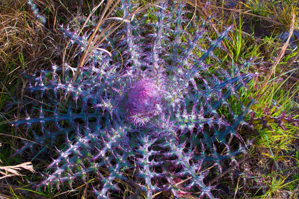
Thistle on Kaufmans Island
Kathy standing next to wire grass on Kauffmans Island
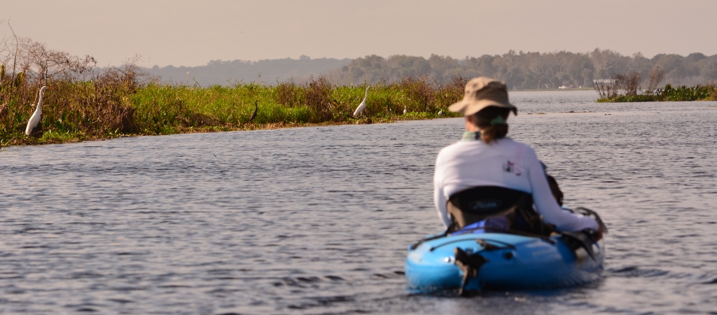
On this day, I headed out to Orange Lake, in the town of Orange Lake between Ocala and Gainesville, off US Highway 441. I launched at the Heagy-Burry ramp, a county park. It has a concrete boat ramp, a floating dock, a few picnic tables, and a porta potty. There’s a restaurant next to the park and a convenience store about a mile down the road. Pretty laid back atmosphere. If you’er into clubbing, you’re in the wrong place.
Typical view along the shoreline
At times, Orange Lake has open waters and has lots of areas to explore and fish. That’s how it was on this trip. At other times, the lake can be clogged with floating islands of tussock and water weeds. Until recently, the Heagy-Burry boat ramp was completely clogged. Apparently, the lake was sprayed with herbicide to kill some of the weeds. Mechanical chompers were also used to tear apart the tussock mats. Debris from the tussocks was everywhere, but paddling around was still easy. This is definitely not a swimming lake!
I wanted to get sunrise photos so I had to get to the lake early. I think paddling in the early morning when the day is fresh is the best time. It’s also cooler which is a major consideration now that summer is almost here. With a heat index of over 100 degrees in the afternoon and no suitable place to go for a refreshing swim, early or late day paddling is the only way to go.
Blue Heron looking for breakfast
I paddled out to one of the smaller floating islands to capture the sunrise. With heavy clouds on the horizon, the sun did not become visible for another 10 minutes. The Redwing Blackbirds, Ospreys, Anhingas, and Herons made their presence known. The Limpkins were very vocal but I didn’t see them as they were hidden in the tall grass of these islands. Orange Lake has its share of big gators, swimming along with just their nose and eyes exposed. When you’re in a plastic yak just inches above the waterline, those gators can look even bigger! Lucky for me, they’re not interested in skinny old dudes with no more sense than to paddle into an alligator’s home turf looking for a good photo.
I started paddling around 6:15 AM and was pulling out at the boat ramp around 8:30 AM. The heat was just starting to set in, but I got out on the lake for the best 2 hours of the day. I paddled about 4 miles, but could have done more if I weren’t taking pictures.
Maybe humans are just the pet alligators that God flushed down the toilet – Chuck Palahiniuk
Best light is at sunrise
Heron taking flightMoorhen looking for yummiesRed-Wing Blackbird
Rum Island Springs is located on the Santa Fe River, north of High Springs (Florida). This is a free county park with a concrete boat-ramp and some picnic tables. A couple of porta-potties were noted, but were in need of cleaning. Since this trip was on a Monday, there were only a few people at the park. I’ve heard Rum Island can really live up to its name on the weekends though. We noticed some trash along the river banks, probably from a weekend of partying.
Sunlight hitting the air plants
The spring is right on the banks of the river, so no spring run. However, Blue Springs is located a stone’s throw from Rum Island and has extensive recreational facilities but is privately run and is not free. You can paddle up the run to Blue Springs, go swimming, but you cannot get out on shore without paying a fee. A few miles downriver is Ginnie Springs, another privately run park with several springs. As with Blue Springs, you can paddle into the springs but will have to pay a fee if you come ashore. Ginnie Springs is also popular with scuba divers.
Nice sandy kayak launch site
We launched from a small beach area on the river, as this is easier than using the concrete ramp. As per usual protocol, we started out by going up river first. A few minutes of paddling from Rum Island spring is a small, unnamed spring on the banks of the river-an inviting, quiet, peaceful little spring tucked away just inside the tree line of the river. There are a few homes along the river, but abundant wildlife. We saw a turkey fly across the river, several kingfishers, herons, anhingas, hundreds of turtles, jumping mullet, an owl and a couple of wild yakers!
High and fine literature is wine, and mine is only water; but everybody likes water – Mark Twain
Small unnamed springs
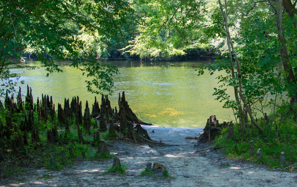
An old growth cypress tree on the river
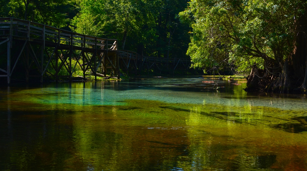
Confluence of clear spring water from Blue Springs and the tannin in the river
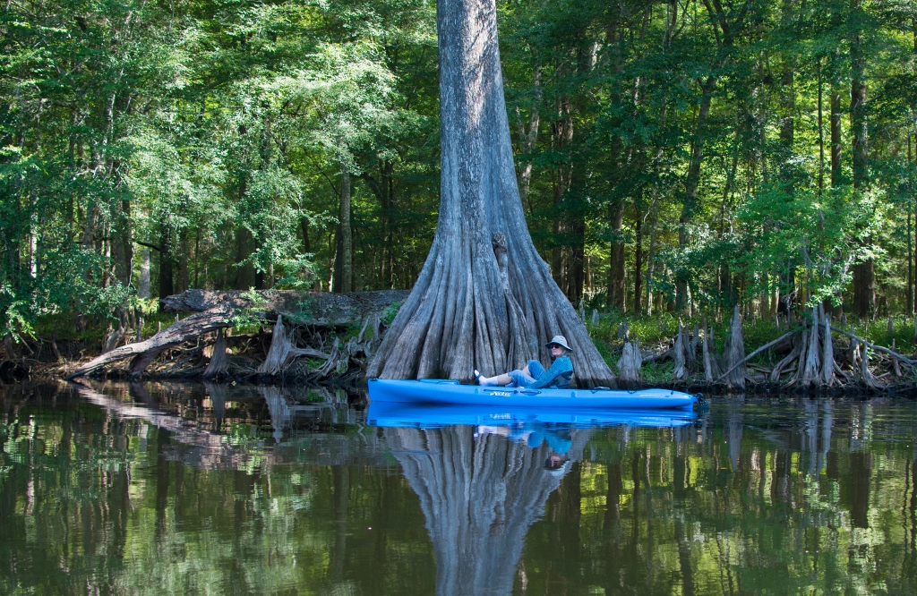
Kathy paddling over the boil at Blue Springs
Underwater shot of Blue Spring runTaking in the sights!
I know there have already been several posts regarding the Oklawaha River/Rodman Reservoir draw-down. This may be my last one on the topic as the dam is to be closed and the reservoir is starting to fill back up. Instead of repeating what I have already said in previous posts, I am posting photographs only. Enjoy!
Palm growing out of old cypress stump. Soon to be drowned!The kayak is 12′ long. This was one big cypress!Blue Heron doing a poseThe possibilities!
A play on words?Photo of the photographerLife is already regenerating just in the few months since the draw-down began
When scientifically investigating the natural world, the only thing worse than a blind believer is a seeing denier – Neil deGrasse Tyson
Orange Springs launch site
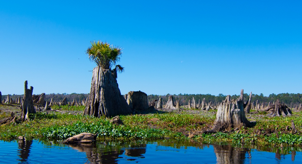
I know I wrote earlier posts about the Oklawaha River, but I want to get as many photographs of the draw down before the river is flooded by the closing of Rodman Dam. My journey started at the confluence of Orange Springs run and the Oklawaha River. As in the earlier trip from here, you have to drive beyond the normal boat ramp/park area on a dirt road out into the Rodman Reservoir. On this morning, the fog was so thick I could barely see across the river, about 75 yards. I’m glad I didn’t try for sunrise photos as the sun was barely noticeable.
Blue Heron taking flight
I launched the kayak around 9:00 AM and headed out to the main channel. Less than a minute out, I hit a snag underwater and tore the rubber flipper on the kayak’s drive. I limped back to the launch, repaired the flipper, and headed out again. During the rest of the trip, I hit a couple of hidden stumps but no damage. If you use a Hobie peddle drive kayak, be careful of hidden stumps and limbs.
Rest stop
The current was noticeably stronger compared to previous trips. I paddled upstream for about 3 miles stopping several times to take photographs. I even walked around on a couple of islands formed by the low water levels. About a mile upstream is the beginning of an old forest with thousands of stumps. In the fog, it had a surreal feeling with all these long dead stumps giving testimony about what used to be here.
I was hoping to see some of the hidden springs on this trip but to no avail. I would have needed to go another few miles upstream, towards Eureka. According to the GPS coordinates I entered, there were several small springs further west. I hope to get out on the Reservoir at least one more time before the dam is closed and the springs are buried again under several feet of backwater, . sometime in early March 2016.
It is with rivers as it is with people: the greatest are not always the most agreeable nor the best to live with – Henry Van Dyke
Early morning mist in the cypress graveyardYoga!Wood Stork giving me a talk’n toThis use to be a forest!
We decided to brave the frigid cold weather on this Christmas day and take the yaks out on the frozen lake. We donned our long underwear, wool hats, and super insulated gloves and headed out to the frozen wasteland. Well, maybe in a parallel universe. Actually, when we launched it was in the mid 70’s and within a few hours, it was in the low 80’s. El Nino is wreaking havoc in the mid-west, but it’s still summer/fall here.
Low winds, smooth water, nice reflections
We wanted to stay close to home, so we decided to paddle Cross Creek again. The water level is up in the creek as well as in Orange Lake and Lochloosa Lake. Cross Creek is a natural waterway (approximately 2 miles long ) connecting these two lakes. In the past, both lakes have been choked with floating islands (tussocks), but they are fairly open now.
Canal leading to Cross Creek
We launched at the free ramp at the Marjorie Kinnan Rawlings Park, which is closer to Orange Lake. The park has two concrete boat ramps, picnic tables, and restrooms. Since it was Christmas morning, there were only a few boat trailers at the park when we arrived. You paddle along a narrow canal (heading for Lochloosa) for about 1/3 mile before you enter Cross Creek. Here, the creek is much wider. Even though the water flows from Lochloosa to Orange Lake, there was no discernable current. With light winds, the smooth water offered many reflection images and made paddling/peddling quite easy.
Blue Heron looking for breakfast
If you don’t have your own yaks or canoes, you can rent one at Twin Lakes Fish Camp, right on the banks of Cross Creek. You can also rent a noisy motor boat if you must. We only encountered a couple of these motorboats today though. Most of the trip was quiet with the soothing sound of moorhens and herons breaking the silence. We noticed a ramp at a motel next to the bridge over the creek, but it looked closed.
If you live in the Gainesville area and are looking for an easy nearby paddle, head over to Cross Creek. With both Orange and Lochloosa Lake mostly cleared, you could spend many days exploring the area. Or, if you’re looking for a quick paddle with much to see, head on over to the creek.
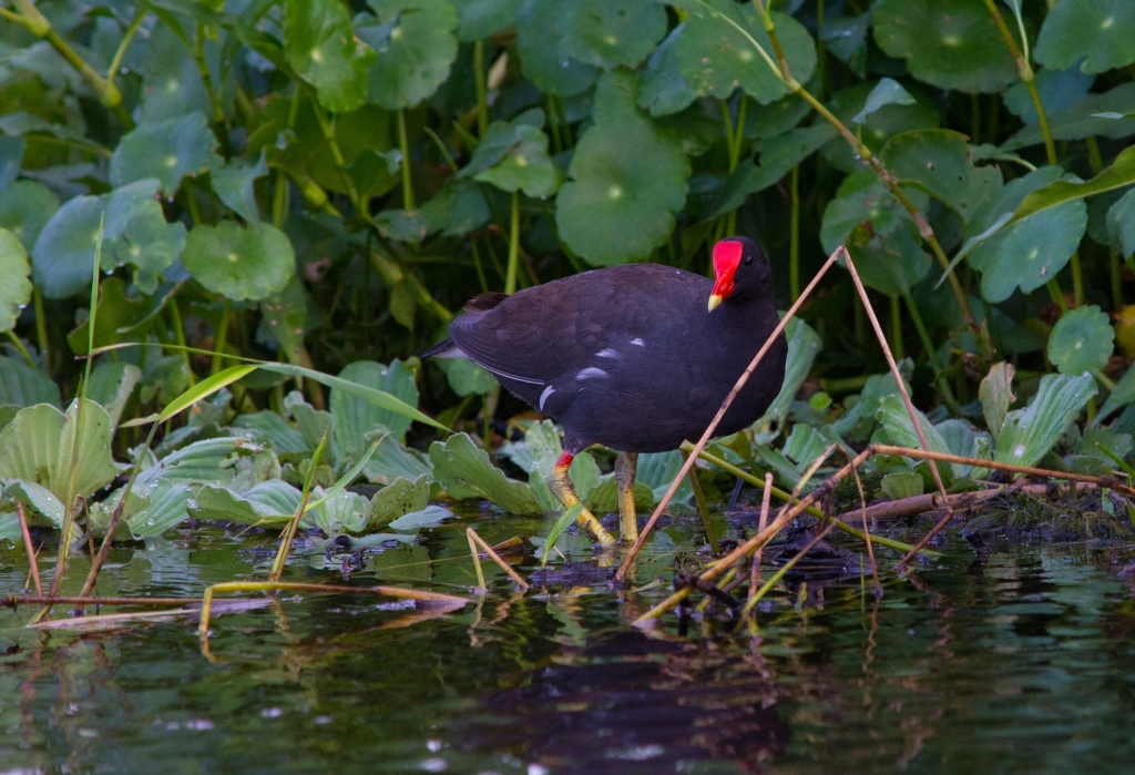
Moorhen posing for shotMoody skies over Lake Lochloosa & Cross Creek convergence.Scenic views along creekWhite Herons feeding along bank of Orange Lake
Do not go where the path may lead, go instead where there is no path and leave a trail – Ralph Waldo Emerson
Folks touring the river
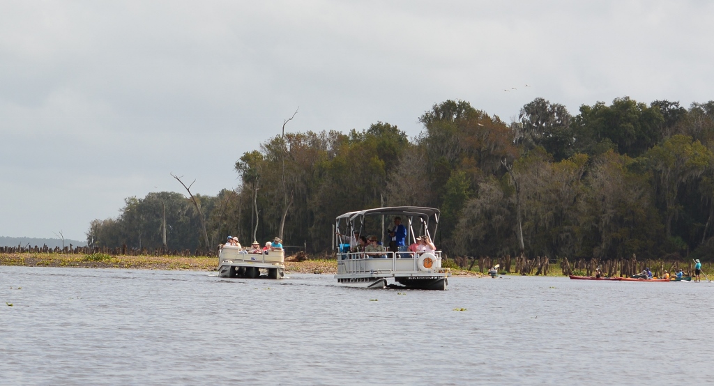
For a slightly different approach, I decided to take a guided tour of the Rodman Reservoir draw-down. This event was hosted by the Florida Defenders of the Environment and was led by Lars Anderson of Adventure Outpost. The purpose of the tour was to let people see what the Rodman Reservoir has done to the Oklawaha River and surrounding land. During the draw-down, the bones of the old cypress forest on either side of the Oklawaha are exposed.
Yakers gathering at the start
Our trip started at the temporary boat ramp at Kenwood Park, on the north side of the Rodman Reservoir. On our last trip to the reservoir a couple of weeks ago, the temporary Kenwood ramp was not open as the water level was still too high. As with the Orange Springs temporary ramp, the Kenwood ramp is out in the middle of the reservoir. It rained the night before our tour so some of the parking area was muddy. On the plus side, there are a couple of portable restrooms here. The weather was supposed to be cloudy with a high chance of rain. Well, it was cloudy but not a single drop of rain. The wind was out of the east at 10 to 20 mph which affected the kayaks’ steering at times but also kept the temperatures down.
Bones of the old cypress forest
We launched out from the ramp into the dredged channel. After following it west for about a mile, we made our way through shallow water into the original Oklawaha River. You could get a sense of the twists and turns the river made while observing the thousands of tree stumps. Apparently, the trees weren’t cut this high but were left to die when the reservoir was first filled in the late 1960’s. The cypress trunks above the water line decayed and washed away. The trunks below the water level have been preserved. With the draw-down in progress, there were many wading birds using the now exposed lake bottom as a feeding ground.
There were several kayaks, a couple of canoes, and one SUP (stand up paddleboard). There were also two pontoon boats with a dozen folks on each. From what I understand, there will be three tours over three days.
The draw-down will continue to early March, 2016. With the weather turning cooler, this is a good time to see an event that only happens every few years. Grab your kayak, canoe, boat or whatever floats and head out to the reservoir. It’s not the prettiest sight, but it’s important to see for yourself what our government policies are doing to our river.
NOTE: The Army Corps of Engineers built the Rodman Dam creating the Rodman Reservoir in 1968 as part of the failed Cross Florida Barge Canal. They have since determined there is no purpose for the dam and it should be removed, returning the Oklawaha River and basin area. Government interference has kept this from happening over the past several years. Maybe it’s time for the dam to be gone! There’s an interesting article at: http://www.sptimes.com/News/041401/Opinion/Rodman_Dam_removal.shtml
Its not what you look at that matters, its what you see – Henry David Thoreau
Our fearless guide Lars AndersonTwo pontoon boats were also on tourRiver resident
To talk much and arrive nowhere is the same as climbing a tree to catch a fish – Chinese Proverb
Kenwood Park boat ramp
We heard the draw-down of the Rodman Reservoir had begun, so we decided to check out the Oklawaha. I read that a temporary boat ramp was made at the Kenwood Park/boat ramp due to the low water but it wasn’t there. We met some other yakers who read the same thing and were looking. We decided to head down to the Orange Springs boat ramp, a few miles west of Kenwood. The canal from the boat ramp was just mud and not navigable. However, we saw a dirt road leading out from the corner of the parking area and figured this was it. We were right. After a half mile on a bumpy but drivable dirt road, we arrived at a cleared space in the middle of what used to be the lake.
Temporary road leading to temporary ramp
A temporary boat ramp has been made right next to the outflow of Orange Springs, but you can launch yaks and canoes just about anywhere. A stone’s throw from the boat ramp, across the river, is the Hog Valley boat ramp. Right now it’s an easy paddle going up or down river as there is very little current, but the current in the Orange Springs outflow is quite strong. I paddled up the outflow for a hundred yards and it was a struggle.
One of the things I wanted to do was to see some of the submerged springs that become exposed during the draw-down. I entered the coordinates for six of these springs in my GPS. They were all within a mile of the Kenwood ramp, but since we couldn’t launch there and with our late start, we decided to try again another day. Instead, we headed towards the small town of Eureka going upstream.
Temporary ramp in the middle of the lake!
A 1/4 mile from where we launched, we started seeing thousands of old cypress stumps which are now exposed. When the river was dammed back in the 60’s, thousands of acres were flooded and the existing trees died. I’m not sure if the trees were logged first. If they were, I’m not sure why they would leave the stumps so high. If you get out of the marked channel, you can hit a muddy bottom or still submerged stumps. It will be interesting to see the area at the peak of the draw-down. It looks nothing like the Oklawaha River when the reservoir is full.
Orange Springs run at the Oklawaha River
On our drive home, we looked for a launch site on the Orange Springs run. The spring head is privately owned but I think the spring run is open. We looked at it going under a bridge on C.R. 21 and it was yakable there. This could be a fun trip down stream only, ending at the Oklawaha River.
NOTE: There are no facilities at the temporary ramp. Not sure if any will be added. Also, I heard a temporary ramp will be built at Kenwood when the water level gets low enough. The draw-down is scheduled to last until early March, 2016.
Never give up; for even rivers someday wash dams away – Arthur Golden
White Ibis feeding at boat rampPaddling in the channel through old cypress forestTemporary ramp at Hog Valley ParkReflecting skyWood Stork. A face only a mother could love!
Climate is what we expect, weather is what we get – Mark Twain
I have kayaked Newnans Lake several times over the past two years but have never sailed it. Even though it’s November, the weather is summer like. High’s in the upper 80’s with winds out of the WSW from 10 to 15 mph; it could be the last good weather sailing day of the year.
Newnans Lake is a 5,800 to 7,500 acre lake (depending on what source you use) about two miles east of Gainesville, Florida. This is a typical shallow basin lake with an average depth of five feet with the deepest portion at twelve feet. However, the summer rains have filled the lake nicely with plenty of depth for sailing (at least with multihull and non fixed keel boats).
Powers Park
The launch site I used was Powers Park, on the southwest side of the Lake, just off S.R. 20. This site is a county park and has restrooms, pavilions, two concrete boat ramps, floating dock, and a fishing pier. Also, all utility lines in the parking and ramp area are buried with no overhead wires. This makes moving the boat around with the mast up much easier. There are, however, some trees you have to watch for.
From the boat ramp, there is a canal leading out to the open lake with some overhanging
Boat ramp, dock, and canal leading to lake
limbs near the edge of the canal. Since the wind was at my back going out, avoiding the overhang was easy. Once I got a couple hundred yards out, the wind filled in and off I went! Sailing back to the ramp wasn’t quite as easy. The wind was dead ahead and no room to tack, so I had to paddle. Without giving me forward lift, the sail became a wind anchor. I would have been better off dropping the sail at the mouth of the canal making it an easy paddle to the ramp. I needed the exercise anyway!
Newnans Lake is mostly known as a fishing lake. I saw a dozen motor boats and bass boats scattered around the lake. In all the kayak trips I have taken on the lake, I have never seen a sail boat. I have heard there were catamaran regattas here in the 1970’s and 80’s but nothing in the past 20 or more years.
I use a set of large inflatable wheels under the boat to hand launch the catamaran, usually off a beach. Since there was no real beach, I had to use the concrete boat ramp. This turned out much easier than I thought. Putting the boat into the water is almost always easier, as you are going downhill. This ramp was gradual enough that I had no problems hand towing the boat out. I prefer this method of launching as I don’t have to submerge the trailer wheels in the water and many beaches are not accessible by motorized vehicles.
It would be nice to see more sailboats on Newnans but it’s just not as sexy as Lake Santa Fe, which is another 10 miles northeast. However, when the water levels are up and the winds are warm, this is a fun place to sail. And no, I didn’t see a single alligator!
View between the hullsEagle PointFishing PierJust hanging out in the hood!

 We were all ready to take the yaks out to the new Blue Springs State Park on the Santa Fe River, when we realized it was spring break for area schools. With warm weather, we figured the large crowds would be a noisy distraction. Instead, we headed over to Cross Creek where we haven’t been for several months. The boat ramp is located next to the Marjorie Rawlings Historic State Park.
 The water level was about average with little to no current noticed. The cool morning air and light breeze made for an easy paddle. The creek is approximately 1 mile long and runs between Orange Lake and Lake Lochloosa.